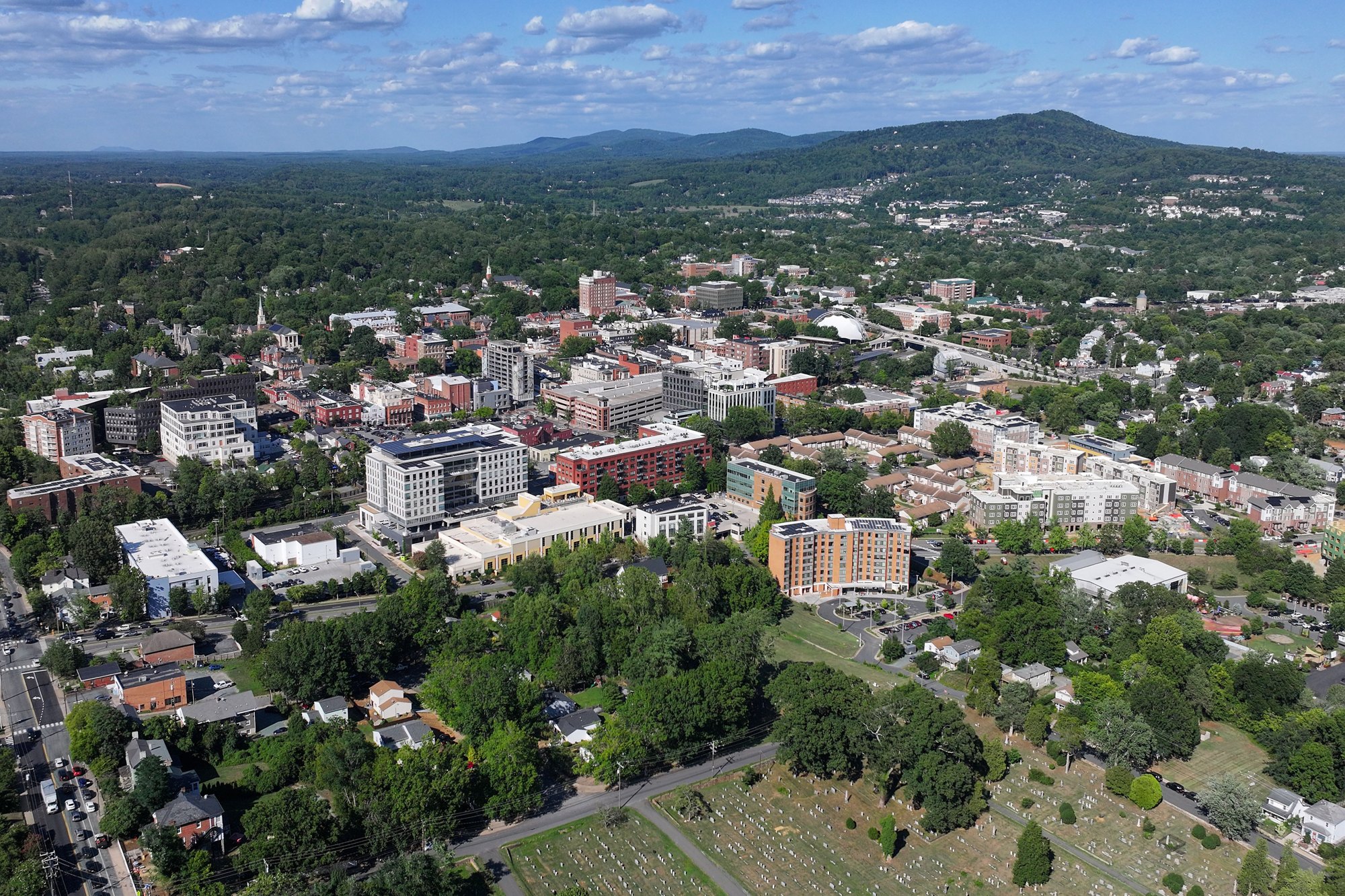
Downtown Charlottesville viewed from above (2026-07-30 17:17:58)

Outdoors

Hiking near Charlottesville

National forests, parks, lakes and recreation areas with hiking trails near Charlottesville, closest first.

33places to hike
18 mito the closest
5within 30 miles
February–June, September–Decemberbest months

Good to know: Carry more water than you think you need, check the managing agency’s page for trail closures and fire restrictions, and start early on hot days.

Closest picks

1

Loft Mountain Campground

18 mi northwest · National Park Service

Perched on top of Big Flat Mountain, this is one of the largest campgrounds in the park. Loft Mountain is a popular destination for outdoor enthusiasts, providing a wilderness getaway in the historic Blue Ridge mountains of Virginia.

2

Lewis Mountain Campground

27 mi north · National Park Service

This location is available on a first-come, first-served basis only. Visitors are required to physically arrive at the campground to purchase and claim a site.

3

Sherando Lake Group Camp

28 mi west · USDA Forest Service

Sherando Lake Group Camp is a part of the Sherando Lake Recreation Area and is popular with family groups, Boy and Girl Scouts, church groups and other local organizations.

Map of all 33 places

Map of 33 places loads as you scroll.

Within 30 miles (5)

18 mi northwest · National Park Service · Campground

Loft Mountain Campground

Perched on top of Big Flat Mountain, this is one of the largest campgrounds in the park. Loft Mountain is a popular destination for outdoor enthusiasts, providing a wilderness getaway in the historic Blue Ridge mountains of Virginia.

  • Camping
  • Hiking
  • Wildlife viewing

27 mi north · National Park Service · Campground

Lewis Mountain Campground

This location is available on a first-come, first-served basis only. Visitors are required to physically arrive at the campground to purchase and claim a site.

  • Backpacking
  • Camping
  • Hiking
  • History
  • Picnicking
  • Scenic Drive
  • Wildlife viewing

28 mi west · USDA Forest Service · Campground

Sherando Lake Group Camp

Sherando Lake Group Camp is a part of the Sherando Lake Recreation Area and is popular with family groups, Boy and Girl Scouts, church groups and other local organizations.

  • Accessible Swimming
  • Backpacking
  • Birding
  • Camping
  • Fishing
  • Hiking
  • Star Gazing
  • Swimming

28 mi west · USDA Forest Service · Campground

Sherando Lake Group Picnic Shelter

Sherando Lake Group Picnic Shelter, also known as the Williams Branch Group Picnic Shelter is a part of the Sherando Lake Recreation Area.

  • Accessible Swimming
  • Boating
  • Camping
  • Fishing
  • Hiking
  • Picnicking
  • Swimming

30 mi west · USDA Forest Service · Campground

Sherando Lake Recreation Area Family Camping

Sherando Lake Recreation Area's Family Campground provides an ideal camping destination.

  • Accessible Swimming
  • Camping
  • Canoeing
  • Fishing
  • Hiking
  • Kayaking
  • Photography
  • Picnicking

30 to 75 miles (19)

31 mi north · National Park Service

Shenandoah National Park

Just 75 miles from the bustle of Washington, DC, Shenandoah National Park is a land bursting with cascading waterfalls, spectacular vistas, fields of wildflowers, and quiet wooded hollows.

  • Camping
  • Climbing
  • Fishing
  • Hiking
  • Horseback riding
  • Picnicking
  • Wildlife viewing

34 mi north · National Park Service · Campground

Big Meadows Campground - Shenandoah (VA)

Secluded in the thick trees and rolling hills of Shenandoah National Park, the Big Meadows Campground is the ideal spot for an outdoor family getaway.

  • Backpacking
  • Berry Picking
  • Biking
  • Birding
  • Camping
  • Evening Programs
  • Guided Interpretive Walks
  • Hiking

37 mi south

Bear Creek Lake State Park

Nestled in the heart of the Cumberland State Forest in central Virginia, Bear Creek Lake is less than an hour west of Richmond. It's the perfect getaway for the outdoor enthusiast.

  • Biking
  • Boating
  • Camping
  • Fire Lookouts/Cabins Overnight
  • Fishing
  • Hiking
  • Horseback riding
  • Nature education

49 mi south · National Park Service

Appomattox Court House National Historical Park

On April 9, 1865, the surrender of the Army of Northern Virginia in the McLean House in the village of Appomattox Court House, Virginia signaled the effective end of the nation's largest war.

  • Hiking
  • History
  • Picnicking
  • Wildlife viewing

51 mi north · National Park Service · Campground

Mathews Arm Campground

Secluded in the thick trees and rolling hills of the Shenandoah National Park, Mathews Arm Campground is the ideal spot for a camping getaway.

  • Camping
  • Hiking
  • Wildlife viewing

56 mi southwest · National Park Service · Campground

Otter Creek Campground

Otter Creek Campground is located at the Blue Ridge Parkway's lowest elevation, only 649 feet above sea level. Picturesque Otter Creek winds through this quiet, rustic campground.

  • Birding
  • Camping
  • Fishing
  • Hiking
  • History
  • Photography
  • Wildlife viewing

58 mi east · National Park Service

Fredericksburg & Spotsylvania National Military Park

Fredericksburg, Chancellorsville, Wilderness, and Spotsylvania, this is America's battleground, where the Civil War roared to its bloody climax. No place more vividly reflects the War's tragic cost in all its forms.

  • Biking
  • Hiking
  • History

62 mi north · USDA Forest Service · Campground

Elizabeth Furnace Group Camp

Elizabeth Furnace Recreation Area offers forested trails, campsites and open grassy picnic areas along the tranquil Passage Creek. Enjoy hiking the Pig Iron and Charcoal trail and learn how iron was historically mined and smelted.

  • Biking
  • Camping
  • Fishing
  • Hiking
  • History
  • Hunting

65 mi southwest · USDA Forest Service · Campground

Hopper Creek Group Camp

Hopper Creek Group Camp offers a rustic atmosphere under the trees for group camping. Nestled in the Blue Ridge Mountains, the area welcomes visitors to enjoy the natural beauty and relaxing atmosphere.

  • Backpacking
  • Camping
  • Canoeing
  • Fishing
  • Hiking
  • Hunting
  • Kayaking

65 mi north · USDA Forest Service · Campground

Trout Pond Recreation Area

Trout Pond Recreation Area boasts two bodies of water, Rock Cliff Lake and Trout Pond. Relax on a sandy mountain beach or fish for stocked trout while relaxing along the cool waters of Rock Cliff Lake.

  • Camping
  • Fishing
  • Hiking
  • Swimming

66 mi southwest · USDA Forest Service · Campground

Cave Mountain Lake Family Camp

Cave Mountain Lake Family Camp is nestled in the Blue Ridge Mountains of Virginia, and welcomes visitors to enjoy the rustic and peaceful getaway.

  • Camping
  • Fishing
  • Hiking
  • Swimming
  • Wildlife viewing

66 mi southwest · USDA Forest Service · Campground

Cave Mountain Lake Group Camp

Cave Mountain Lake Group Camp is nestled in the Blue Ridge Mountains of Virginia, and welcomes visitors to enjoy the rustic beauty and peacefulness of the area.

  • Camping
  • Fishing
  • Hiking
  • Picnicking
  • Swimming

66 mi southwest · USDA Forest Service · Campground

Cave Mountain Lake Group Picnic Shelter

Cave Mountain Lake Group Picnic Shelter is nestled in the Blue Ridge Mountains of Virginia, and welcomes visitors to enjoy the rustic beauty and peacefulness of the area.

  • Biking
  • Camping
  • Fishing
  • Hiking
  • Picnicking
  • Swimming

69 mi northeast · National Park Service · Campground

Chopawamsic Backcountry Camping Permits

Looking for some peace and quiet? Want to get back to nature, listen to the sounds of the nocturnal world, or simplify your life? Then come experience primitive camping at Prince William Forest Park’s Chopawamsic Backcountry Area.

  • Backpacking
  • Birding
  • Camping
  • Fishing
  • Hiking
  • Photography
  • Wilderness
  • Wildlife viewing

70 mi northeast · National Park Service

Prince William Forest Park

Prince William Forest Park is an oasis, a respite of quiet and calm. In 1936, Chopawamsic Recreation Area opened its gates to house children's 'relief' camps during the Great Depression.

  • Biking
  • Camping
  • Fishing
  • Hiking
  • History
  • Picnicking
  • Wildlife viewing

72 mi northeast · National Oceanic and Atmospheric Administration

Mallows Bay-Potomac River National Marine Sanctuary

Mallows Bay-Potomac River National Marine Sanctuary is home to a diverse collection of shipwrecks, as well as an array of wildlife inhabiting the surrounding area of Mallows Bay.

  • Bird Watching
  • Canoeing
  • Fishing
  • Hiking
  • Hiking Trail
  • History
  • Kayaking
  • Photography

73 mi northeast · Bureau of Land Management

Douglas Point Special Recreation Management Area

The Douglas Point Special Recreation Management Area (SRMA) in Charles County, Maryland, offers fantastic opportunities for hiking, horseback riding, hunting, fossil collecting, and relaxing along the shore.

  • Biking
  • Fishing
  • Hiking
  • Horseback riding
  • Nature education
  • Photography
  • Ranger programs
  • Snorkeling

74 mi northeast · National Park Service

Manassas National Battlefield Park

On July 21, 1861, two armies clashed for the first time on the fields overlooking Bull Run. Heavy fighting swept away any notion of a quick war.

  • Fishing
  • Hiking
  • History
  • Horseback riding

75 mi southeast · National Park Service

Richmond National Battlefield Park

The center of Confederate manufacturing fueled a modern war, one of the South’s largest hospitals gave care to the sick and wounded, and armies battled on open fields and in miles of defensive earthworks.

  • Hiking
  • History

75 miles and farther (9)

78 mi northeast · Fish and Wildlife Service

Featherstone National Wildlife Refuge

Featherstone National Wildlife Refuge consists of 325 acres of woodland and freshwater tidal marsh.

  • Boating
  • Fishing
  • Hiking
  • Hunting
  • Paddling
  • Photography
  • Wildlife viewing

79 mi northeast · Fish and Wildlife Service

Occoquan Bay National Wildlife Refuge

Occoquan Bay National Wildlife Refuge was established in June 1998 to provide habitat for migratory birds and endangered species.

  • Biking
  • Educational Programs
  • Fishing
  • Hiking
  • Hunting
  • Photography
  • Ranger programs
  • Wildlife viewing

80 mi southeast · National Park Service

Petersburg National Battlefield

Two hundred ninety-two days, eight offensives, over 70,000 casualties, U. S. Colored Troops, and the decline of Gen. Lee's Army of Northern Virginia all describe the Siege of Petersburg. U.S.

  • Biking
  • Hiking

82 mi northeast · Fish and Wildlife Service

Elizabeth Hartwell Mason Neck National Wildlife Refuge

Elizabeth Hartwell Mason Neck National Wildlife Refuge was established in 1969, and became the first national wildlife refuge created specifically for the protection of bald eagles.

  • Educational Programs
  • Fishing
  • Hiking
  • Hunting
  • Photography
  • Ranger programs
  • Wildlife viewing

82 mi northeast · Bureau of Land Management

Wood Thrush Trail

One mile loop trail on the 800 acres of the Meadowood SRMA on Mason Neck in Fairfax County, Virginia and plans to manage it to provide open space for recreation, environmental education, and wild horse and burro interpretation.

  • Hiking
  • Horseback riding
  • Ranger programs
  • Wildlife viewing

83 mi northeast · Bureau of Land Management

Meadowood Special Recreation Management Area

The Meadowood Special Recreation Management Area (SRMA) offers 13.4 miles of hiking trails, 7 miles of horseback riding trails and 6.6 miles of mountain biking trails.

  • Biking
  • Fishing
  • Hiking
  • Horseback riding
  • Mountain Biking
  • Ranger programs
  • Trail Running
  • Wildlife viewing

84 mi northwest · USDA Forest Service

Monongahela National Forest

  • Biking
  • Boating
  • Camping
  • Climbing
  • Fire Lookouts/Cabins Overnight
  • Fishing
  • Hiking
  • Hunting

87 mi northwest · Fish and Wildlife Service

Canaan Valley National Wildlife Refuge

Canaan Valley National Wildlife Refuge, the nation’s 500th was established on August 11, 1994, with the purchase of 86 acres. The refuge currently is 18,986 acres.

  • Biking
  • Boating
  • Cross Country Skiing
  • Fishing
  • Hiking
  • Horseback riding
  • Hunting
  • Nature education

88 mi east · Fish and Wildlife Service

Rappahannock River Valley National Wildlife Refuge

Rappahannock River Valley National Wildlife Refuge was established in 1996 to conserve and protect fish and wildlife resources, including endangered and threatened species and wetlands.

  • Educational Programs
  • Fishing
  • Hiking
  • Hunting
  • Non-Motorized Boating
  • Photography
  • Wildlife viewing

Distances are straight-line miles from the center of Charlottesville. Listings come from Recreation.gov’s federal recreation database; check each official page for hours, fees, fire restrictions and closures before you go.

Get outside around Charlottesville

More outdoors near Charlottesville

Questions

Where is the closest place for hiking near Charlottesville?

Loft Mountain Campground (National Park Service), about 18 miles northwest of Charlottesville as the crow flies. Next are Lewis Mountain Campground (27 mi) and Sherando Lake Group Camp (28 mi).

When is the best time for hiking near Charlottesville?

Based on Charlottesville’s average highs, February–June, September–December. Conditions at higher elevations can be much cooler.

Who manages these places?

Federal agencies including National Park Service, USDA Forest Service, Fish and Wildlife Service. Each listing links to its official page for hours, fees, closures and current conditions.

Charlottesville AI

Your Charlottesville local guide
Hey there!

I'm Charlottesville AI. Ask about neighborhood food, independent shops, local history or planning a visit.

AI recommendations may be inaccurate. Verify hours and prices. Questions are processed by Cloudflare. Privacy